

A smarter way to plan cities
UCity at CoMotion LA
November / 11 / 2025
UCity is presenting a glimpse of our journey at CoMotion LA 2025, highlighting the convergence of simulation architecture, real-time data, and LLM-powered decision systems. Our showcase demonstrated how AI-driven city twins redefine sustainability and governance in urban environments.
San Jose Pilot Expansion
October / 18 / 2025
The San Jose pilot entered advanced testing with the integration of adaptive energy management, public transport modeling, and dynamic routing for micro-mobility. The city’s digital twin now supports continuous simulation-based policy evaluation.
Web Platform for Urban Visualization
September / 20 / 2025
We launched a web-based platform for interactive simulation and visualization of the San Jose Mobility Hub zones. The platform allows planners to test mobility scenarios, visualize data layers, and evaluate outcomes before real-world deployment.

Android App Beta & San Jose Collaborations
August / 04 / 2025
We released the beta version of the UCity app on the Google Play Console for testers in San Jose. The beta introduced simulation layers, live annotations, and analytics tools for mobility and infrastructure planning.
.png)
San Jose Mobility Hub Kickoff
June / 18 / 2025
In collaboration with Vinnova and the City of San Jose, UCity began planning and implementing two micro-mobility hubs along East San Fernando Street. These hubs focus on optimizing last-mile connectivity and sustainable urban transport.

Cityverse & Olympic Simulation Showcase
May / 22 / 2025
At the Cityverse Conference, UCity presented a large-scale simulation designed for the 2028 Summer Olympics. The demo, developed with TrainBrain and Kaleidoscope, showcased city-wide energy distribution and transport optimization for high-density events.
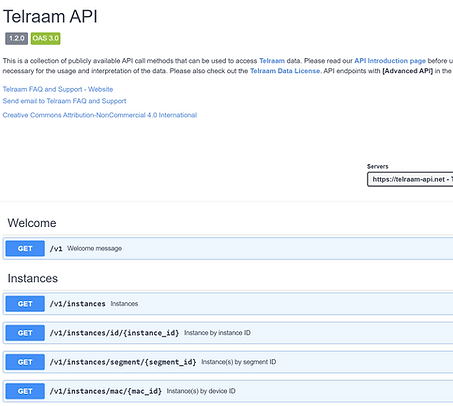
real-Time APIs with Tampere Municipality
April / 09 / 2025
UCity partnered with Tampere Municipality and Telraam to integrate real-time mobility and environmental data into our simulation engine. This enabled live traffic monitoring and predictive modeling powered by Telraam’s open APIs.

Beta Testing and Data Integration
March / 14 / 2025
We refined the app based on beta test feedback, addressing bugs and improving stability. Simultaneously, GPS integration enabled live annotations and spatial feedback from users, feeding into our backend for real-time updates and analytics.
App Development and Object Gallery
February / 12 / 2025
Our teams developed the Object Gallery — a library of modular 3D assets like benches, trees, and environmental markers for city simulations. Feedback loops from early testers guided asset optimization and usability improvements within the UCity platform.

Digital Twin Pilot Discovery
January / 18 / 2025
We began 2025 by scoping the Digital Twin Pilot, defining area specifications, data sources, and 3D modeling parameters for our first comprehensive municipal deployment. This phase focused on discovery, data integration, and defining project timing.
Gamla Stan Simulation & Data Platform
October / 18 / 2024
UCity launched a detailed traffic and environment simulation for Gamla Stan, addressing congestion, emissions, and spatial management challenges. The platform visualizes the effects of interventions like pedestrian zones, adaptive logistics, and self-driving mobility to support evidence-based urban policy.
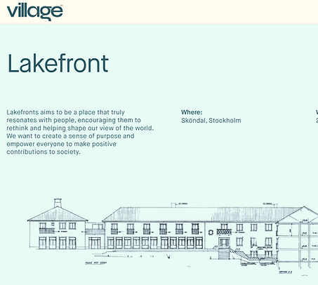
Co-Creation at Lakefront
August / 22 / 2024
We met collaborators and potential partners at the Village Hub in Stockholm for an on-site exploration of co-creation opportunities around the Lakefront project. The session connected architects, planners, and technologists to discuss digital twin applications in sustainable neighborhood planning.
Alignment and Roadmap Finalization
July / 05 / 2024
After extensive assessments with project partners, UCity defined its trajectory for city-scale simulations and AI integration. The outcomes provided a clear roadmap for incubator-to-demonstration transition, establishing core metrics for mobility, sustainability, and infrastructure readiness.

Structuring Collaborative Ecosystems
June / 10 / 2024
We refined our proposal frameworks and coordinated development tracks across partners. Explored high-potential urban solutions, aligning research, actors, and budgets for demonstrations launching later in the year.
urban insights Framework
May / 02 / 2024
UCity participated in Vinnova’s evaluation for transformative projects, focused on real-time urban simulation and mobility optimization. The initiative set the foundation for our demonstration roadmap — emphasizing measurable city impact, scalability, and co-creation with municipalities.

UCity, Smart Visualizer & The train brain
March / 28 / 2024
We are enhancing our digital twins by integrating our technology with Smart Visualizer's platform, using triangulated carrier data from The Train Brain to enrich our mobility analysis. This strategic collaboration enables us to track urban movement patterns accurately while maintaining privacy. Our goal is to leverage these advanced tools to demonstrate the significant benefits of digital twins in urban planning, illustrating how they can inform smarter and more effective city development strategies.

Simulating citizen Behavior
January / 17 / 2024
We're using reinforcement learning to infuse digital 3D actors, including pedestrians, bikes, and vehicles, with human-like behaviors derived from underlying city data.
These actors simulate realistic interactions within our 3D environments, encompassing a range of urban dynamics.
Our approach is focused on enhancing the accuracy of our simulations, providing deep insights into the movements of pedestrians, cyclists, and vehicles without relying on conventional gaming tropes.

Visualizing
urban dataflow
December / 8 / 2023
We're working with anonymized carrier data to map out how people move around in cities, in 3D.
To get a clearer picture of urban flows, turning abstract data into something that can be visually navigated and understood, almost like watching the city from a bird's-eye view.

Visual Intelligence
October / 13 / 2023
UCity is looking beyond text-based insights.
We're integrating a state-of-the-art model equipped with both visual and textual understanding.
It's equipped to understand the urban environment on a profoundly granular level—from real-time visual patterns to public sentiment.

AI URBAN INSIGHTS
September / 15 / 2023
We're researching Llama 2, an open foundational large language model that can be fine-tuned on custom dataset.
We're customizing Llama 2 using unique datasets harvested from diverse city APIs & other channels offering insights into urban development
This dataset enables us to fine-tune Llama 2's models to work in sync with our existing segmentation, machine learning, and geolocation tools, creating a unified system that's exceptionally context-aware.

nvidia inception
August / 06 / 2023
UCity is now part of the Nvidia Inception Program!
Our journey towards revolutionizing urban simulation and sustainable city development has gained even more momentum.
This collaboration underscores our commitment to shaping smarter, greener, and more efficient cities through advanced technologies.

ucity project download
July / 29 / 2023
Our 3D city game, showcased at Zero City, Tekniska Museum, is now available for download!
Immerse yourself and interact with our crafted urban city simulation environment.
Experience the real-time data analysis as you navigate through the bustling streets, witness mobility patterns, and make strategic decisions that shape the city's future.

LLMs for deep city insights
May / 16 / 2023
UCity is working on fine-tuning a large language model (LLM) with social city context.
The LLM is based on a unique dataset sourced from city APIs, providing targeted insights into urban development, social sciences, and policy-making.
The LLM is trained and integrated into the game engine with 3D city environment, leveraging segmentation, machine learning, and geolocation data to make decisions based on 3D visual data.

the ucity platform
December / 09 / 2022
Ucity platform is focused on providing a real-time, comprehensive view for tracking various metrics like energy grid mix, mobility patterns, traffic heatmaps, and more by aggregating data from various sources. This data is used to create 3D city simulations.
The platform enables informed decision-making and planning processes, contributing to the development of sustainable and livable cities.

mobility simulation platform
September / 25 / 2022
We’re showcasing our mobility simulation platform inside a 3D city environment, at the Tekniska Museum at Stockholm.
We're simulating Toyota e-Palettes to move around in the city and interact with pedestrians, cars, etc. to analyze their behavior and patterns, and make it ready for the real world.
All this while people at the museum play this "game" and immerse into a futuristic city.

Next gen mobility
July / 16 / 2022
Our city environment engine reflects how a city works.
It uses systems like AI traffic and pedestrians, physics simulation, rule-based event triggers, with reinforced learning to train AI algorithms for optimizing the mobility simulation.
We simulate paths and behaviour of autonomous & rule-based mobility vehicles to forecast their effects in the city traffic ecosystem and how their deployment could be improved.

Street to car
intelligence
June / 08 / 2022
We're rethinking the safety of unprotected road users which has long been forgotten about.
Our system allows a seamless end-to-end collaboration with car manufacturers to enable vehicles receive a real-time spatial map of their surrounding geolocation with intelligence filters.

Zero city twin
March / 09 / 2022
A real-time digital twin platform built using Unreal Engine 5.
Used as a simulation platform to get the city to zero carbon emission

Zero City exhibition
February / 01 / 2022
Participating to demonstrate our real-time people tracking into a digital avatar in the Zero City exhibition which is focused toward planning the transportation of people and goods in the fossil-free city of tomorrow, in order to achieve climate goals.
Read More at Tekniska Museet.

Tampere Pilot project
January / 10 / 2022
Collaboration with the SURE! Project in Tampere, Finland to deploy digital avatars by tracking people in the city with an existing citywide camera system.
Invited to showcase our tech at Dubai Expo 2020
Read more about the SURE! project

December / 10 / 2021
Collaboration to get an open, decentralized digital twin platform by inviting all companies in the city to take part by deploying their tech on the platform for visualization and making decisions.

November / 09 / 2021
Dashboard development with geotagging and heatmaps for a energy company.


edge device Test site development
October / 23 / 2021
From the city officials perspective, it is essential to understand how the different objects in the street relate to each other.

September / 25 / 2021
General Data Protection Regulation GDPR compliance requires companies to clearly define their data privacy policies and going through a Data Inspection. Ucity was approved by GDPR for using privacy filter.

August / 12 / 2021
We decide to take matters in our own hands and travel to different areas of the world to investigate how different cities work and explore perspectives of how people wanna live in the future.
Cities are the most complex systems on the planet run by humans. It is imperative to get multiple perspectives into account and make decisions accordingly

allas network
July / 09 / 2021
Allas Network is a subsidiary to Ucity. It focuses on the technical aspects of planning cities, by deploying smart IoT devices with sensors to track relevant data from a city.
This collection of data is interfaced in real-time using smart dashboards and also updated in a digital version of the city for visualization and making decisions.
https://allas.network
sensors in a smart city
June / 04 / 2021
Smart city is infeasible without the deployment of sensors. The sensors, like street cameras, environmental, GPS, microphone, etc., when used in conjunction with neural networks, can be used to develop and analyze data from speech recognition, video, image, and natural language processing.
The analyzed data is used to make important decisions and monitor environments to guarantee citizens of security

what is a smart city?
May / 08 / 2021
IoT, and cloud computing has become central to the implementation of Smart Cities with a required connectivity between the sensor nodes.
A Smart City refers to the proper use of resources through the application of real-time technologies that automate some tasks. Sensor technologies are essential for cities as they present an operational and feasible environment.

